Fleet visibility for Westchester operators

Fleet GPS Tracking in Westchester County for Vehicles, Tools, and Equipment

Westchester County fleet tracking should answer the questions that slow an operation down: Where is the truck? Did it reach the site? How long was it stopped? Where did the trailer or tool case go? Btracking connects vehicles, equipment, and field activity to data your office can use without chasing drivers for updates.

Btracking Platform Fleet

See where the work is happening

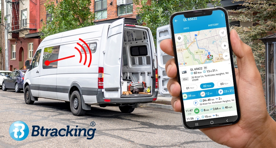
A fleet map is useful. The operating history behind it is where managers get answers. Real-time vehicle location shows current position, while route, stop, and idle history provides a record of the day after it happens. Dispatch can check progress before assigning the next call. Operations can review an unexpected stop without reconstructing the route from memory. When a customer asks when a vehicle reached the property, the office has a timestamp to reference instead of another phone call to the field.

Built around a Westchester operating day

Westchester fleets rarely stay on one road or inside one type of territory. A service day may run from Yonkers and New Rochelle to White Plains, Mount Kisco, or Peekskill, with I-287, I-684, US-9, and the county parkways shaping the route. Dense commercial areas, residential calls, supply-house stops, and equipment yards create different tracking needs. Btracking is based at 340 US-202 in Somers, so this page is not built around a generic state-level service area. It is built around the way local vehicles and field assets move through the county.

Track more than the truck

The vehicle is only one part of a field operation. Trailers, generators, compressors, machines, tool cases, and other assets can sit away from the driver or move between crews. Battery and solar asset trackers cover equipment that does not have a standard vehicle connection. AirTracker tags provide another path for smaller items. For businesses that need inventory-level visibility, Btracking’s tool tracking options extend the tracking plan beyond vans and pickups. The device should follow the asset, not force every asset into the same hardware category.

Choose the right tracker for each asset

Start with how the vehicle or equipment is used, powered, and supervised. The hardware decision becomes much clearer from there.

  • Plug-in vehicle trackers: A practical path for compatible fleet vehicles when the operator wants a removable device and direct vehicle connection.
  • Hardwired vehicle trackers: Better suited to vehicles or machines where a fixed connection and less accessible placement make more sense.
  • Battery asset trackers: Built for trailers, equipment, and movable assets without dependable vehicle power.
  • Solar asset trackers: A fit for outdoor assets where sun exposure supports the use case.
  • AirTracker tags: A smaller format for tools, bags, and other compact items.

Review the plug-in and hardwired tracker comparison, then match the reporting interval, power source, and asset type to the actual job.

Use route and idle history to manage the day

Route history turns a moving dot into an operating record. Managers can review the order of stops, time spent at each location, travel between calls, and idle periods that need a closer look. That record supports dispatch reviews, job sequencing, customer questions, and internal conversations about how the day was used. It also reduces dependence on handwritten notes or recollection. The goal is not to watch a screen all day. It is to have clean information when a route, stop, or delay needs an answer.

Set boundaries that report movement

Geofences let an operator draw a digital boundary around a yard, jobsite, customer property, storage area, or other important location. Alerts can then report arrivals, departures, or movement tied to that boundary. For a Westchester contractor, that may mean knowing when a trailer leaves the yard. For a delivery or service fleet, it may mean confirming that a vehicle entered the assigned area. Good alerts are selective. Start with locations and events that require action, then avoid burying the office in notifications nobody uses.

Add video when location data is not enough

GPS data explains where the vehicle was and how it moved. Video adds road context. Btracking’s AI GPS dashcams can be included when a fleet needs a clearer record around driving events, incident review, or driver coaching. A camera is not required for every tracking plan, and it should not be treated as a substitute for clear fleet policy. It is another source of evidence. Pairing video with vehicle location and event data gives a manager more context than either source provides alone.

Start with the management question, not the device list

A five-vehicle service company and a mixed fleet with trucks, trailers, and powered equipment should not buy the same setup by default. Define the first question the system needs to answer: vehicle location, route proof, unauthorized asset movement, tool visibility, or video context. Then choose the hardware and platform around that priority. Larger or more varied operations can review the enterprise platform. Businesses operating north of the county can also review Putnam County fleet tracking. Electrical contractors should see the dedicated GPS tracking guide for electricians in Westchester and Putnam.

Questions fleet managers ask before choosing a tracker

Btracking offers hardware paths for cars, vans, light trucks, heavier vehicles, trailers, equipment, tools, and other movable assets. The right device depends on the asset’s power source, size, operating environment, and the type of location history or alerts the business needs.

Plug-in units suit compatible vehicles where easy connection and removal are useful. Hardwired units fit vehicles or equipment where a fixed connection and less accessible placement are preferable. A mixed fleet can use different device types rather than forcing one choice across every asset.

Yes. Route, stop, and idle history provides a record that managers can review after the operating day. That information is useful for dispatch questions, customer arrival checks, route review, and internal follow-up.

A geofence is a digital boundary around a location such as a yard, jobsite, or customer property. The system can issue alerts tied to entry, exit, or movement events, based on the tracker and configuration selected.

List the vehicles and assets you want to track, how each one is powered, where it operates, and the main question you need the system to answer. Include any need for dashcams, equipment tracking, tool tags, route history, or geofence alerts.

Keep comparing

Putnam County fleet tracking

Vehicle, route, equipment, and alert planning for Putnam operators.

GPS tracking for electricians

A field-operations plan for service vans, tools, and electrical equipment.

Tool tracking

Compare tags and GPS devices for tools and movable equipment.

Get a tracking plan built around your Westchester operation

Bring Btracking a list of your vehicles, trailers, equipment, and tools. The team will help you compare hardware and platform paths around the assets you run and the information your office needs. Call 475-999-2385 or use the contact form to start the conversation.

Your Cart (0)
Welcome Guest! Create an account to save your cart! Register Already a customer?
Empty Cart Your Cart is Empty!

It looks like you haven't added any items to your cart yet.

Browse Products
Subtotal
Shipping & taxes calculated at checkout.
$0.00
Checkout Now

Btracking Beats
the Competition!

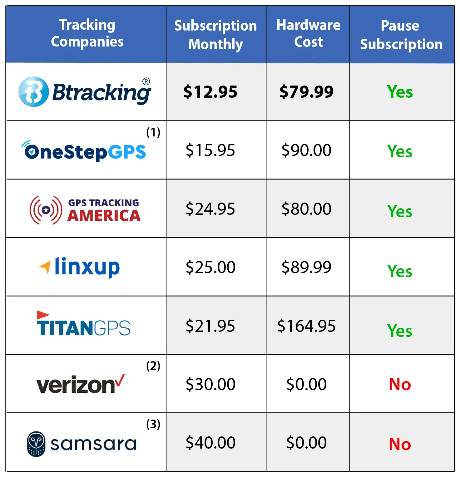
GPS Tracking Cost Comparison

Btracking- GPS-Tracking Price Comparison Chart

(1) Free tracker also offered; may be a used device & must be returned to pause/stop subscription. $2/month add-on required for accurate speed limits. Contract available with a lower hardware price but prohibits pausing. (2) Hardware included in subscription price. (3) Hardware included in subscription price and must be returned to pause/end subscription.

Comparisons made Oct 21-30, 2024. Pricing is per vehicle, based on a fleet of 10 light vehicles.

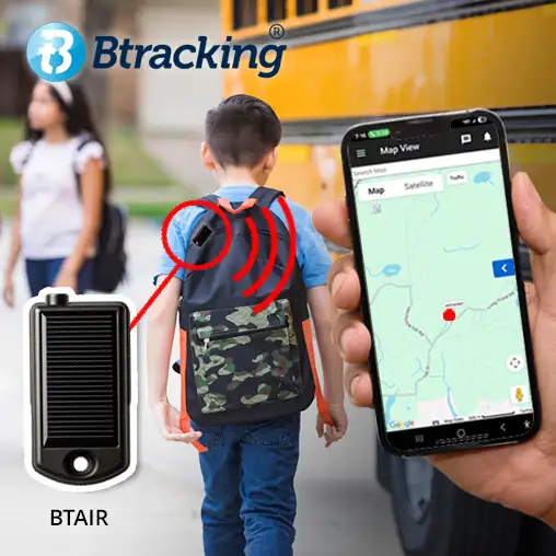
Btracking BTAIR Solar Powered Mini Air Tracker
Introducing The

BTAIR

A Mini Solar-Powered GPS Tracker

Track any asset or person with the new solar powered Mini Air Tracker from Btracking. GPS tracking for just pennies a day!